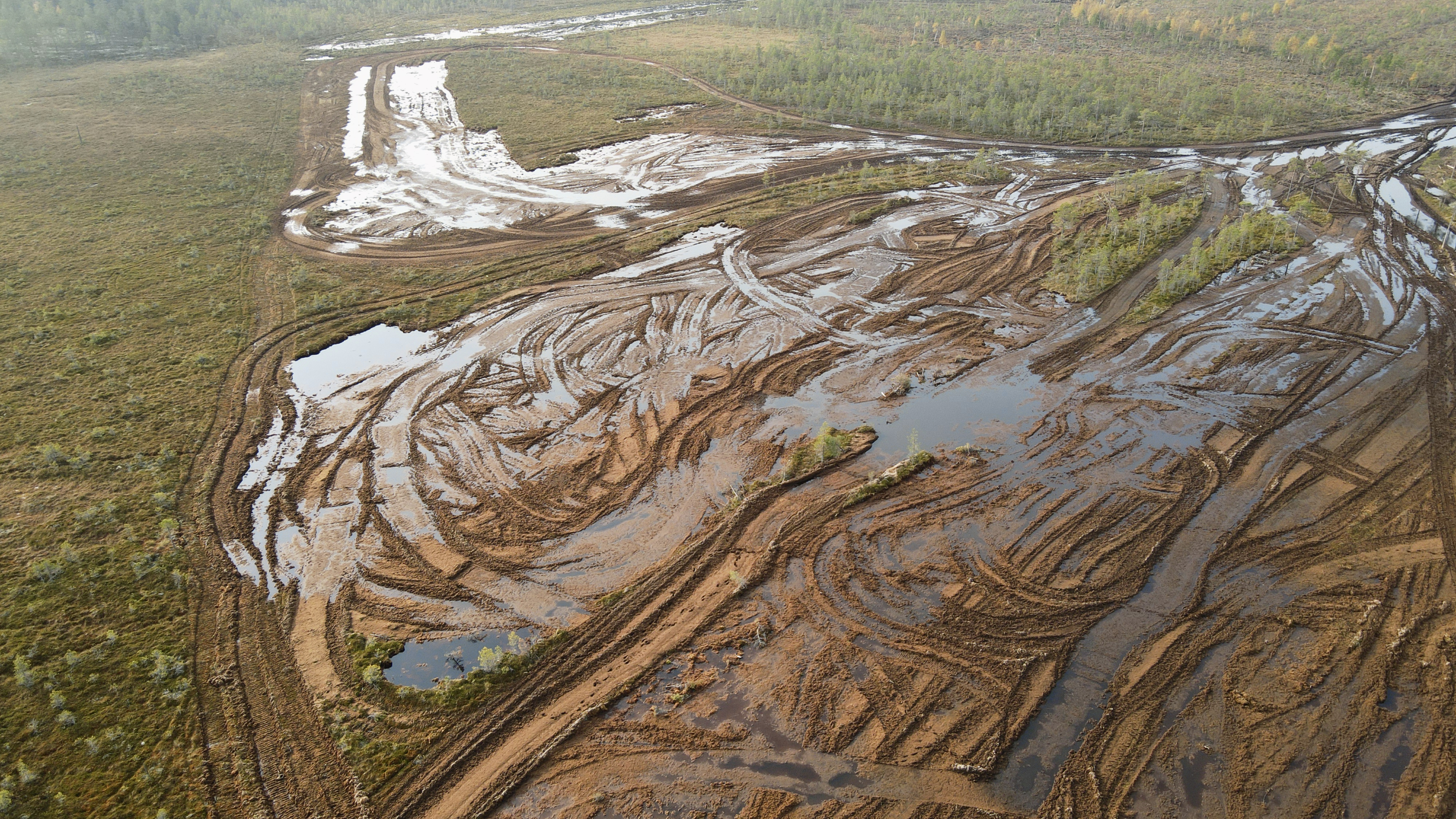
Located in Kihniö, Finland, Sarvineva is a regionally valuable mire complex, most of which is still in the virgin state. While no peat harvesting permit has been granted for the mire, EcoMoss, owned by Biolan (a major Finnish producer of garden substrates and fertilisers), has harvested sphagnum moss and surface peat from the mire complex, cutting out layers as thick as half a metre. Biolan has admitted to making a mistake at Sarvineva, but the harvesting of sphagnum moss still continues elsewhere. Sphagnum moss is used for purposes such as growing medium and soil products for home gardens.
Scraping off the surface destroys the mire as a habitat. It requires nothing more than the permission of the landowner yet transforms the mire from a carbon sink into a source of carbon and methane emissions. Restoration can take over 50 years, and the ecological community of the mire may never return to its former state. Most Finnish mire types are classified as threatened, and our mires are home to 280 threatened species.
The bird’s-eye view, or an elevated view observed from above, was central to the anthropocentric outlook on the future that reigned during the first half of last century. It is a familiar sight in contexts such as map applications and the imagery of modern warfare. Today, photographs taken from a bird’s-eye view are also a way to gauge the extent of ecological disasters. The change in perspective enables us to comprehend the scale of environmental destruction that can be difficult to understand from the level of the human eye.
Our economic system has exploited natural resources for maximum profit without concern for the survival of other species. Activities such as mining, forestry, the harnessing of rivers, peat production and the harvesting of sphagnum moss cause huge changes to natural habitats. Their scale is illustrated by aerial photos.